|
|

|
|
Sept. 19, 2004. Sunday Week 1. With the prep work done the journey started Sept. 19, 2004 at 7am local time in Calgary, Alberta, temperature -2ºC.
|
|

|
|
Left Calgary, headed down boring straight Hwy 22 to the border and crossed at Chief Mountain into Montana, United States.
|
|

|
|
We took the south Hwy 2 around Glacier Park, through Whitefish, and then south on Hwy 35/93 to Missoula. |
|

|
|
Clouds were building and as we hit one of our favorite roads Hwy 12, Lolo Pass it started to rain and then snow.
|
|

|
|
Trying to catch snow flakes on the tank bag.
|
|

|
|
In good spirit be pushed on to Grangeville, Idaho and decided to keep on riding to Riggins, were we had camped before. We had put in a good days riding at 1055km. |
|
|
|

|
|
Sept. 20, 2004. Another early start, temperatures were now in the teens as we turned south west at New Meadow. Passed into Oregon at Ontario and west on Hwy ??. |
|

|
|
As luck has it we were stopped twice by the cops in Oregon. First time we were pulled over for passing a Sheriff on a double solid line ($237US each) and only 30 minutes later the highway patrol cop clocked us speeding in a corner. Yeah, he was nice enough to let us off with a warning.
|
|

|
|
All I could think was “let’s get the heck out of Oregon”. We decided to take Hwy 395 south, entered California at the north eastern portion of the state.
|
|

|
|
It was getting late and as we gained elevation the temperatures dropped. So again we pushed on to Reno, Nevada and got a hotel room. Another day of 1017km. |
|

|
|
Sept. 21, 2004. Well rested, with the temperature at +6ºC we re-entered California on Hwy 395.
|
|

|
|
Since we had made some good time/distance we detoured into Yosemite National Park.
|
|
|
|

|
|
Hwy 395 in California. |
|

|
|
View onto Moon Lake, California. |
|

|
|
The road climbed to an impressive 9,945 ft (3,031m) at the Tioga Pass.
|
|

|
|
Artistic Shot:) |
|

|
|
Entering the Park. |
|

|
|
Resting at the top. |
|
|
|
|
|

|
|
The road from Yosemite Park to Hwy 395. |
|

|
|
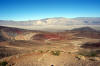
Next destination was Death Valley National Park. Holly Molly, straight road, that is probably the longest dead straight road we have ever seen.
|
|

|
|
Joshua Tree, perfect picture opportunity just before entering the Death Valley Park.
|
|

|
|
Okay, another picture just because. |
|
|
|

|
|
Entering Death Valley National Park. |
|

|
|
Temperatures finally started to warm up to a comfortable +25ºC. Death Valley National Park had just been reopened two weeks prior.
|
|

|
|
In August a huge flash flood hit the Valley and destroyed 90% of the roads.
|
|
|
|
|
The views are incredible and yes there are a couple of twisties.
|
|

|
|
The end of the road with an amazing view of Death Valley. |
|
|
|

|
|
Mmmhh. Another very straight road. |
|
|
|
Another picture opportunity at the Sand Dunes. |
|

|
|
Sand Dunes. |
|

|
|
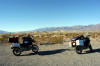
We set up camp at the Furnace Creek Campground. Another day of 620km.
|
|

|
|
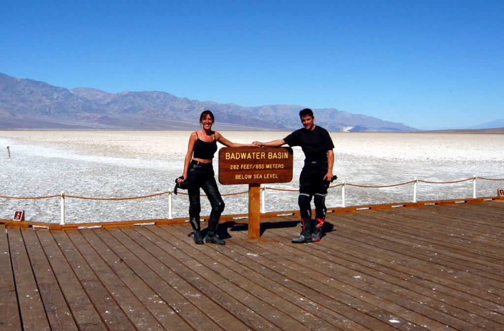
Sept. 22, 2004. After a visit to the museum we rode to the Badwater Basin. Wow straight road as far as you can see. |
|
|
|
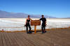
The Badwater Basin is the lowest point in America at 85.5m below the sea level.
|
|
|
|

|
|
The saltwater flats stretched out for miles and Mike couldn't resist tasting the white stuff, that is salt.
|
|

|
|
That is salt and not snow. The road was closed beyond this point due to the floods. |
|

|
|
Backtracking we went down this gravel road to the Natural Bridge, but only got 1km into it and had two close calls in dropping the bikes.
|
|

|
|
The weight of the bikes and deep sandy gravel does not work well together.
|
|

|
|
Instead we took a walk along Golden Canyon.
|
|

|
|
Shade:) |
|
|
|

|
|
It was time to head south again to make San Diego at night fall. Rolled into San Diego late and pitched a tent in a local RV park for free (620km). |
|

|
|
Sept. 23, 2004. Prior to leaving on the trip we had booked Mike's 10,000km (6,000miles) service with Brattin BMW Dealer in San Diego.
|
|

|
|
We dropped of the BMW at 8am for service, ended up buying a new Arai XD Helmet and sending back via mail the Suomy Helmet.
|
|

|
|
Brattin BMW gave Mike a courtesy BMW 650 (Belt Drive) and we scooted over to a nearby lake and waiting for the service to be completed. Were a bit surprised that it took them all day to do an oil change and inspection.
|
|

|
|
Finally on the road, we made our way out of San Diego on Hwy 94 which twists south east to the border crossing at Tecate. We spent the night at the Potrero Regional Park Campground which was located only 5 minutes from the Tecate Border Crossing. |
|

|
|
Sept. 24, 2004. We were at the Tecate border crossing at 8:30am, parked the bikes and started the lengthy process of getting the appropriate paper work. |
|
|
|

|
|
Yeah! We made it to Baja California, Mexico. The contrast from the States to Mexico was apparent immediately. We headed south on Mex. 3 to Ensenada. Road conditions were excellent as we took the sweeping corners on almost new pavement. |
|

|
|
Following Mex. 3 east, we turned just after Trinadad on the Baja 1000 course. Again we felt like little kids at Christmas. Unaware of the of the road conditions ahead, we went on our merry way. |
|

|
|
Sign for Mike's Sky Ranch. |
|
|
|
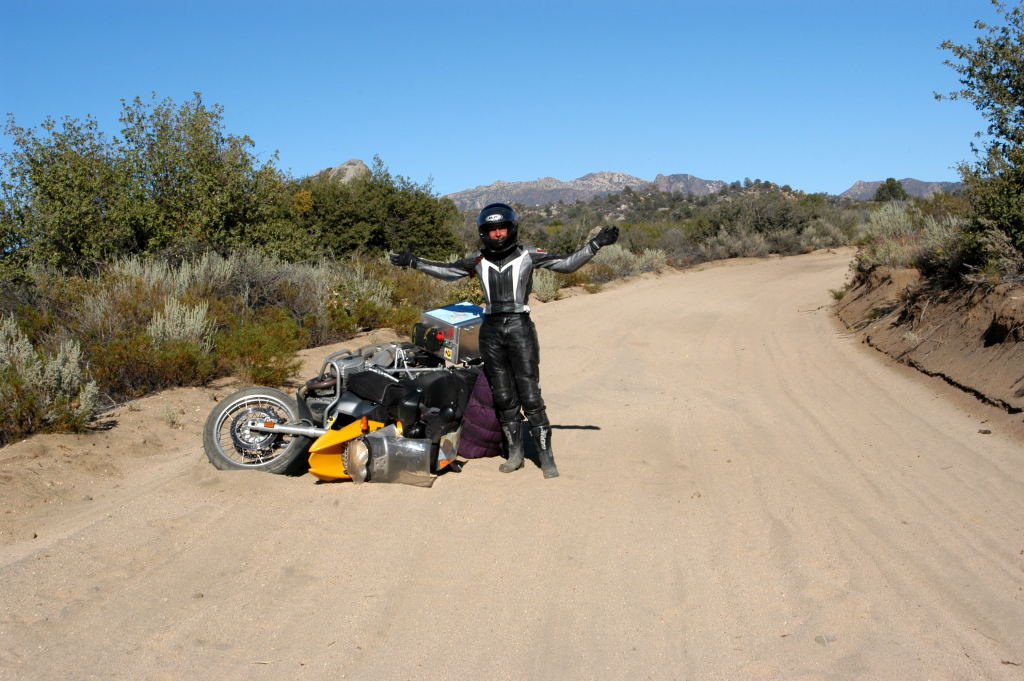
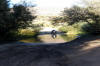
Approx. 17km into the desert mountain range, I had a few close calls of crashing and disappearing in the scrub, and then ......
|
|

|
|
I actually did bite the dust. The dirt road turned into deep sand and before I knew it I was down. No harm done, except for my confidence.
|
|
|
|
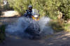
From there it was a major struggle to keep the bike upright. A lot of frustrated tears were shed, but with Mike's help we made it almost to the Ranch.
|
|
|
|

|
|
After the deep sand the road become twisty and very rocky.
|
|

|
|
Stopped at the bottom of a steep hill and only 500m away from the Ranch, we met a bunch of "quaders", followed by a support Van.
|
|

|
|
In the hurry to get out of the Van's way, we clipped the right side BMW bags of Mike’s bike and tore them off. Ty-Wraps come in handy.
|
|

|
|
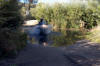
After a fun water crossing we made it to the ranch.
|
|

|
|
This is actually Mike crossing on my bike. |
|

|
|
Close call in dumping the bike as he hits the mud. |
|
|
|

|
|
Yeah! Mike's Sky Ranch. |
|

|
|
We were greeted by another guy on a BMW1150GS (who actually had crashed 3 times), two guys on KTM520's and of course the quaders. Staying at the ranch was $50.00US per night per person and includes, steak dinner and a large Mexican breakfast. |
|

|
|
Sept. 25, 2004. I didn't sleep all night because I was dreading the way out off here. Tried even to swap bikes with the KTM520, but no chance.
|
|

|
|
So here I am crossing the river. |
|
|
|
But before I crossed I walked through it to make sure the water wasn't going to swollow my bike. |
|

|
|
Almost make it. |
|
|
|
|
|
This is what it is all about. |
|

|
|
If you zoom into my face you see total concentration. I was scared shitless. |
|

|
|
The 30km trip out of Mike's Sky Ranch took us 3 hrs, mainly due to me being scared of dropping the bike.
|
|

|
|
The road out. |
|

|
|
On street tires it is a pain in the butt. |
|

|
|
There are some steep hills. |
|
|
|

|
|
Some lone farmer. |
|

|
|
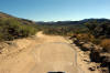
BMW engineering. The plastic piece in the back fell off after the rough road. Who needs it. Back on the pavement we back tracked to Ensenada and then turned south on Mex. 1. Finding a campground was more difficult then we anticipated. There were no signs ever. |
|

|
|
Luckily Mike had printed off some Campgrounds from the Internet which included the GPS coordinates, even with that information it took us most days a couple of hours finding a campground. We made it to San Quintin and set up camp at the La Pinta Campground (100 Peso's).
|
|

|
|
Sept. 26, 2004. Sunday Week 2. At El Rosario we fueled up and were advised that there was no gas for 344km, which meant staying at 120km/hr to get the range on the tank. Breakfast was at the famous Mama's Espinosas Restaurant, known as a Baja Racing stop and excellent Lobster Dinner. |
|

|
|
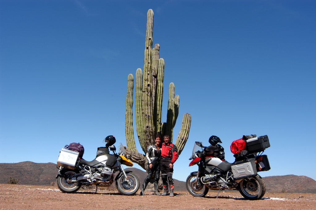
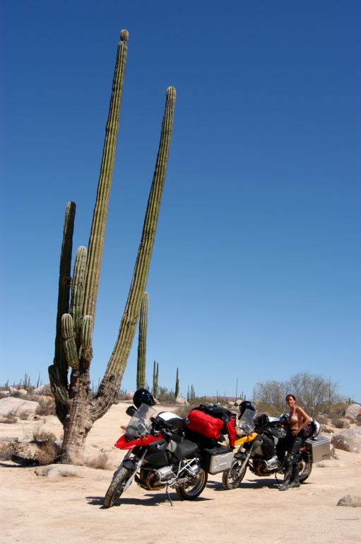
From here it was inland, vast land of sand, cactus' and soaring temperatures.
|
|

|
|
Road Conitions were excellent. |
|
|
|

|
|
Huge Cactus'.
|
|

|
|
We are travelling through Cactus and Desert Country. |
|

|
|
Every stop was brutally hot. |
|

|
|
Pemex is the Mexican Owned Gas Company. Premium was found almost everywhere. Check out the Truck and its huge load. We had planned to stay just before the border crossing from North to South Baja California, ... |
|

|
|
... but once we reached the "so called campground", we just couldn't get ourselves to put up a tent on the hard packed sandy desert RV Park with no protection from the sun or hot furnace wind. We decided to push on. At the crossing from North to South Baja California we had to show our tourist visas.
|
|

|
|
In search for a campground we entered Guerro Negro on the Pacific Coast, but the town itself had no appeal to us and we returned to Mex. 1, heading east. Just before sun set we reached San Ignaco and were pleasantly surpised by it oasis look. Riding a couple of days in the desert, the lush green Palm trees and rivers were unexpected. We were the only campers at the campground with the partial completed washrooms ($10.00US/night). |
|
|
|

|
|
Sept. 27, 2004. Before heading out of town, we returned to the town square and a visit to the local Mission San Ignacia. |
|

|
|
One of the best preserved missions. |
|

|
|
Mission San Ignacia. |
|

|
|
Inside the Mission. |
|

|
|
Altar |
|
|
|
|

|
|
Baja California Scenary. |
|

|
|
Only an hour east of San Ignaco we got our first view of the Sea of Cortez.
|
|
|

|
|
Dangerous Curves, a very common sign. |
|
|
|
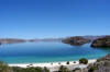
Temperatures stayed in their high 30ºC as we rode along the sea. As we reached the Bay of Conception we were in awe of the magnificent view.
|
|

|
|
We decided to stay for a couple of days and enjoy paradise.
|
|
|
|
|
|
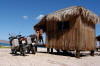
For $20US a night we got a primitive hut on the beach at Buenaventura.
|
|

|
|
Due to its remoteness, water has to be trucked in and the only power available was by generator. Once again, we and another American couple were the only ones to stay at this white beach. The sea was calm, clear and warm and made for some great swimming and sea life viewing. |
|

|
|
Mid afternoon a dozen American dirtbikers took over the bar/restaurant and cleaned them out of all the beer, which meant that we had to contend ourselves with Lime Margaritas, the hard life. It was the dirtbikers annual ritual to ride the Baja 1000 course from Tecate to Cabo San Lucas. |
|

|
|
In the evening the owner invited us over to sit around the fire on the beach, eat fresh Clams and watch the full moon rise. Why we had a fire was beyond me, since the temperature never dropped below 33ºC during the night. We reached 37ºC in the shade every day. |
|

|
|
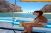
Sept. 28, 2004. A day of relaxation. After breakfast at the restaurant we rented a couple of sea kayaks for the day ($20.00US each). |
|

|
|
We started kayaking along the shoreline and reached a deserted white beach.
|
|
|
|

|
|
I know I will never forget that day, and it is hard to put into words how unbelievable amazing it was. We spent a few hours out on the water and started to get nicely burnt.
|
|

|
|
37ºC in the Shade. The night before we slept little due to the heat and mosquitoes, there had been no breeze. Therefore the next night we decided to take the sleeping bag and sleep outside on the porch. By 6am, we had been eaten alive by the mosquitoes and realized that there is never a breeze. |
|

|
|
Sept. 29, 2004. On the road again. At Loreto we started climbing the mountain range inlet. |
|

|
|
Had to stop here for my Mom. Santa Rita. Heading east on Mex. 1 we spend three (3) hours on the straightest road in Baja California. |
|

|
|
La Paz famous two (2) doves Monument. We arrived in La Paz and stopped at the Tourist Office to get directions for the Ferry Ticket Office. Since we knew that the Ferry does not take vehicles every day, we decided to book early. The Ferry Office is just one block south/east of the town square church (5 o Mayo Street). |
|

|
|
The timing worked out great. We were booked to leave La Paz to Mazatlan for 3pm Oct. 1, 2004. Cost $396.00CDN for two people and two bikes. We set up camp for two (2) days at the Casa Blanca RV Park. |
|
|
|

|
|
Casa Blanca RV Park was located just as you entered La Paz and came with a swimming pool, tennis court, hot showers and locked premises for only $120.00 Peso's/night. In the evening we took a stroll into town center along the shoreline and enjoyed some local ice cream. |
|

|
|
Sept. 30, 2004. Leaving all our gear at the camp site, we set off on our journey south Hwy 1/9. We stopped for breakfast at the famous Hotel California in Todos Santos, from there we followed the coastline of endless beaches to Cabo San Lucas. |
|

|
|
Lost and frustrated in Cabo San Lucas, we almost headed out of the town, but then final found access to the beach. |
|

|
|
For only $20.00US we had a personal glass bottom boat take us out to the famous arch, drop us of at the lovers/ divorce beach and pick us up a couple of hours later. |
|

|
|
This had worked out quite well. We had made it to the tip of Baja California. |
|
|
|
Lover's Beach in the background. |
|
|
|

|
|
This picture still reminds me of two legs and a butt hole. Sorry. |
|

|
|
Famous Arch. |
|

|
|
Cabo San Lucas, the tip of Baja California. |
|

|
|
Sea Lions. |
|
|
|
|
|
|
|
|
|

|
|
Divorce Beach. |
|

|
|
Look... |
|
|
|

|
|
...out... |
|

|
|
...for the waves. |
|

|
|
Deserted Beach. |
|

|
|
Huge.... |
|

|
|
....huge.... |
|

|
|
.....waves. |
|
|
|

|
|
On our way back we past the Topical of Cancer. |
|

|
|
From there we took the scenic east road back to La Paz. After Los Barriles the vegetation is very green as you climb through the mountain range. At El Triunto we stopped for a church picture. |
|

|
|
And Mike pretended to ring the church bells. |
|

|
|
Oct. 01, 2004. It was time to say good-bye to La Paz. My bike needed an overdue oil change, since we had left Canada we had put on 6500km. We found a local Honda dealer, who were excited to have us in there shop. |
|

|
|
We did our own oil change, but were allowed the use of their shop. The BMW oil filter we had purchased in Canada prior to leaving. The total bill for the oil came to $24.00US (and yes it was factory Honda oil). |
|

|
|
La Paz Town Square and Church. |
|
|
|

|
|
The Ferry Terminal Pichiligue is about 16km north of La Paz and they recommended being at the Terminal 1hr prior to departure.
|
|

|
|
Of course we were there 2 hrs prior. The freight consisted mainly of Semi-Trucks. We were loaded last, reminder to self to bring always tie-downs, which we didn't here. |
|

|
|
Sitting on deck we watched La Paz and Baja California disappear. The Ferry took 19hrs to Mazatlan. We slept on the benches outside. |
|

|
|
Oct. 02, 2004. High Humidity is the first thing that hit us as we arrived in Mazatlan at 10am. Even so the temperatures were only in the 30ºC it seemed unbearable. |
|

|
|
Heading south from Mazatlan, we passed through Tepic and winded our way through a lush green mountain range to Puerto Vallerta.
|
|

|
|
Puerto Vallerta Town Square and Church. |
|
|
|

|
|
In search for a campground we got very familiar with the copplestone roads of downtown Puerto Vallarta. |
|

|
|
Oct. 03, 2004. Sunday Week 3. After a visit to the local church, we left Puerto Vallarta behind. |
|

|
|
Road Stop and socializing with the local vendor.
|
|
|

|
|
Some amazing beautiful coast line. |
|

|
|
Still acclimatizing to the high humidity and temperatures we only did 200km and set up camp in San Patricio Melaque. |
|
|
|

|
|
Even so we knew from our research the GPS coordinates of the campground location, it still took us a good 1/2 hr to find it.
|
|

|
|
Another nice spot $12.00US/night right on the beach, which we were the only occupants.
|
|

|
|
As the sun was still up we played in the ocean waves and ended the day sitting at the beach, watching the waves break in the moon light. |
|
|

|
|
I am a bit scared of big wave. There is me trying to run from the wave. |
|

|
|
Oct. 04, 2004. We left the camp at sun rise 7:30am, since we planned for a long day of riding (750km). |
|
|
|

|
|
Another artistic shot of Mike. |
|

|
|
From San Patricio Melaque we stayed on Hwy 200, which winds along the coast all the way from Puerto Vallarta to the Guatamalan border.
|
|

|
|
Our goal was to get as close as possible to Acapulco. After breakfast in La Placita, we rode along the rocky, steep, mountainous and green coast for three (3) hours. |
|

|
|
This stretch of coastline covers one of Mexico’s most beautiful and deserted beaches. |
|

|
|
We met a couple of vehicles on the way, but otherwise had to concentrate on the twisty and sometimes gravely road. |
|

|
|
At San Luis San Pedro we decided to push on to Acapulco, which hadn’t been a good decision. Upon entering Acapulco the sky opened up and we were trenched by a huge thunderstorm, to add to the misery we got lost and ended up in the scary place of town. |
|
|
|

|
|
Oct. 05, 2005. On our way south out of Acapulco, we stopped for a city view. |
|

|
|
Couldn't resist standing beside the Canada Flag. |
|

|
|
Acapulco Downtown View. |
|

|
|
Acapulco City View. |
|

|
|
By noon we were back on Hwy 200, stopped for breakfast in San Marco, were we made the acquaintance of two military men. A military check stop was set up by the restaurant. We spend about 1/2 hour talking to them, which gave me an excellent picture opportunity as well.
|
|

|
|
Locals washing clothes in the muddy river.
|
|
|
|

|
|
Internet Service in Marquelia. Powered by solar panels? After 240km and four (4) hours later, it was time to get a hotel. For $200.00 Peso's we stayed in Pinotepa Nacional.
|
|

|
|
Oct. 06, 2004. Our goal was to make it to Oaxaca today. With sun rise we were on the road heading south on Hwy 200 to Puerto Escondido. |
|

|
|
Mike felt squeezy and opted to skip the usual Mexican breakfast and instead live on chocolate chip cookies. At Puerto Escondido we turned inland on Hwy OAX 131. |
|

|
|
It took us 1 1/2 hours for the first 40km, road condition deteariated, potholes, gravel, and very twisty.
|
|

|
|
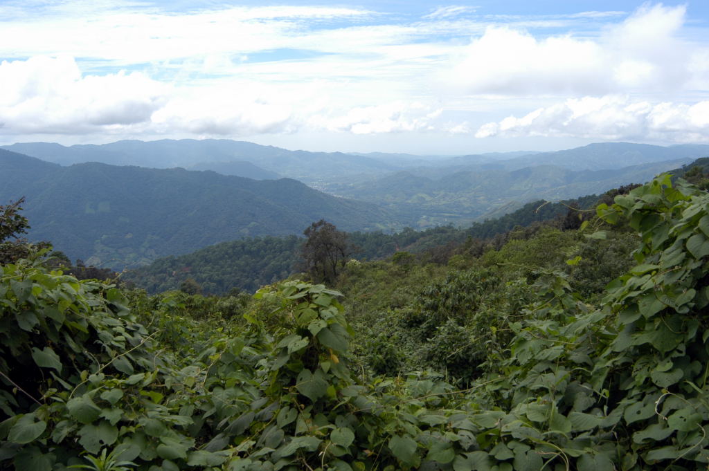
The terrain inlet is very lush and green. |
|

|
|
Donkey's are plendiful on the side of the road. One of the things you have to watch out for when riding in Mexico. |
|
|
|

|
|
More scenary. |
|

|
|
No we didn't dare take the bikes across this bidge. |
|

|
|
Another scenary shot. |
|

|
|
No shoulder in Mexico. |
|

|
|
We had been on the road for about six (6) hours as we came upon a mountain village at about 6400ft elevation. I was not sure of the name of the village, but knew we were somewhere between Lachao and San Pedro Juchatengo, maybe it was the turn-off to Hwy 178. |
|

|
|
Aware that at least another five (5) hours of twisty mountain road lay ahead of us, we were faced with our first Mexcian Stand-off. Looking back now, I am not sure if I handled the situation correctly, but it makes for a good story when with friends. |
|
|
|

|
|
"Well" maintained roads add to the fun of riding. |
|

|
|
We climbed often up to 8500 ft and rode in the clouds. |
|

|
|
It started to rain on and off and we stayed in Zimatlan approx. one (1) hour from Monte Alban. The hotel was $150.00 Peso’s.
|
|

|
|
Oct. 07, 2004. At the top of the world. That is how we felt as we reached the ruins of Monte Alban. |
|

|
|
As usual there was no signage for Monte Alban, as we make our way through Oaxaca.
|
|

|
|
A single lane road twists up the side of the mountain to an impressive 8,200ft, and here Monte Alban spreads itself out over three (3) football fields. |
|
|
|

|
|
Early morning is the best time to visit the ruins, with the clouds in the valley and less tourists. |
|

|
|
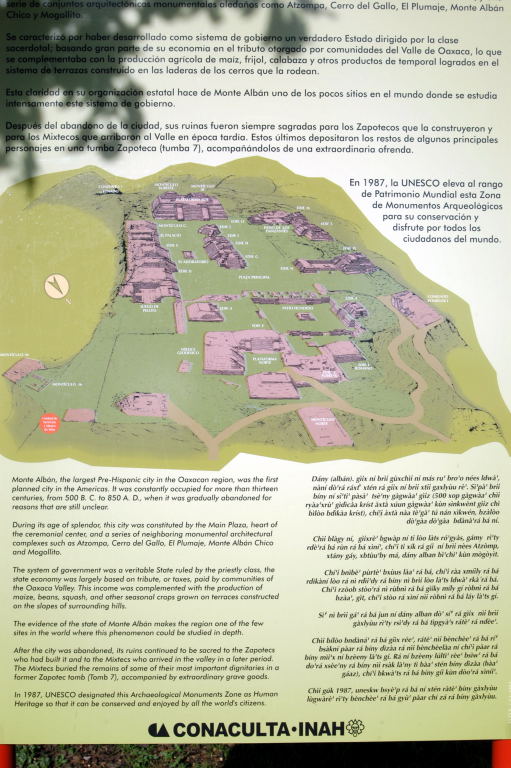
History of Monte Alban. |
|
|
|
Artistic shot. |
|

|
|
Occupied from 500 BC to 850 AD. |
|

|
|
Capital of the Zapotecs. |
|

|
|
Monte Alban means the Scared Space. |
|
|
|

|
|
The actual ruins sit on the top of Jaguar Hill, which was flattened for the Grand Plaza, 400m above the Valley Oaxaca. |
|

|
|
It was designed for religious Ceremonies. |
|

|
|
The Plataforma Sur. |
|

|
|
Walking up Plataforma Sur. |
|

|
|
View over the Plaza. |
|

|
|
The Observatory (Building J) |
|
|
|

|
|
View from Mound Q. |
|
|