|
|

|
|
Donkeys are still used in Yemen's day to day transportation. |
|

|
|
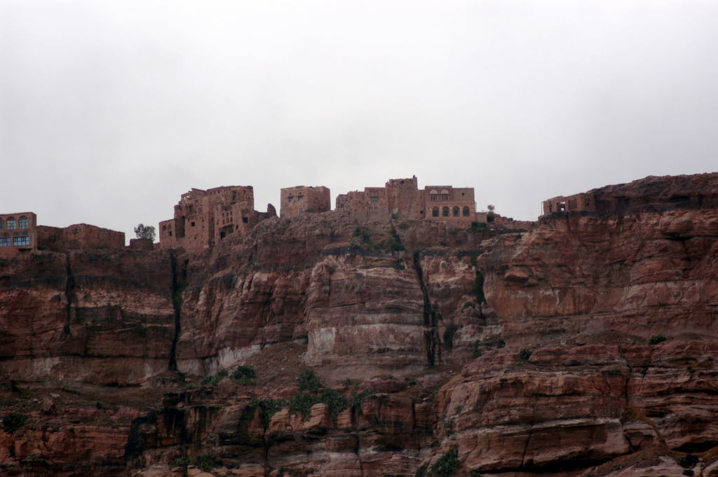
March 23, 2006. Villages are built on top of mountains... |
|

|
|
...stones houses hanging on the side of cliffs. |
|

|
|
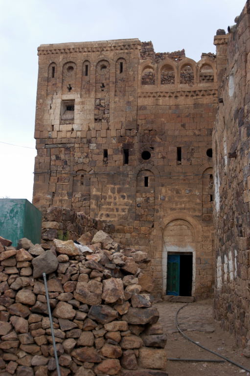
Our first few of the village of Kawkaban. |
|

|
|
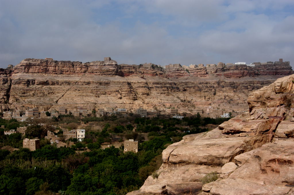
The village is located 2800km from the base of Jebel Kawkaban. |
|

|
|
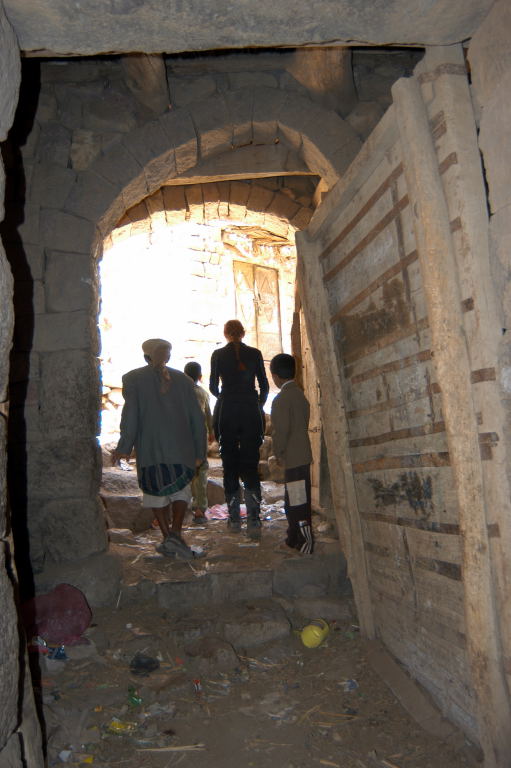
Locals make their home in caves of the mountain. |
|
|
|

|
|
A local boy watches us walk up the mountain. |
|
|
|
Our rocky path up Jebel Kawkaban. |
|

|
|
Great view of Shibam, where we parked our motorcycles. |
|

|
|
Half way up the mountain. |
|

|
|
There is actually a house on the lonely mountain peak. |
|

|
|
Ruby walking along the path and an ancient bridge. |
|
|
|

|
|
We made it to the top and just in case we weren't 100% sure. A English sign. A rare occurance. |
|
|
|
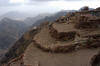
Most of the hill top village had only one (1) entrance gate. |
|

|
|
The village used to be walled... |
|

|
|
...excellent view of the landscapes and Shibam and Thilla. |
|

|
|
A view of the nearby Husn Thula fortress seen from Jebel Kawkaban. |
|

|
|
Closer view of one of the oldest mosques in Yemen in Shibam. |
|
|
|

|
|
The morning souq in full swing. |
|

|
|
Mike enjoying the incredible view. |
|

|
|
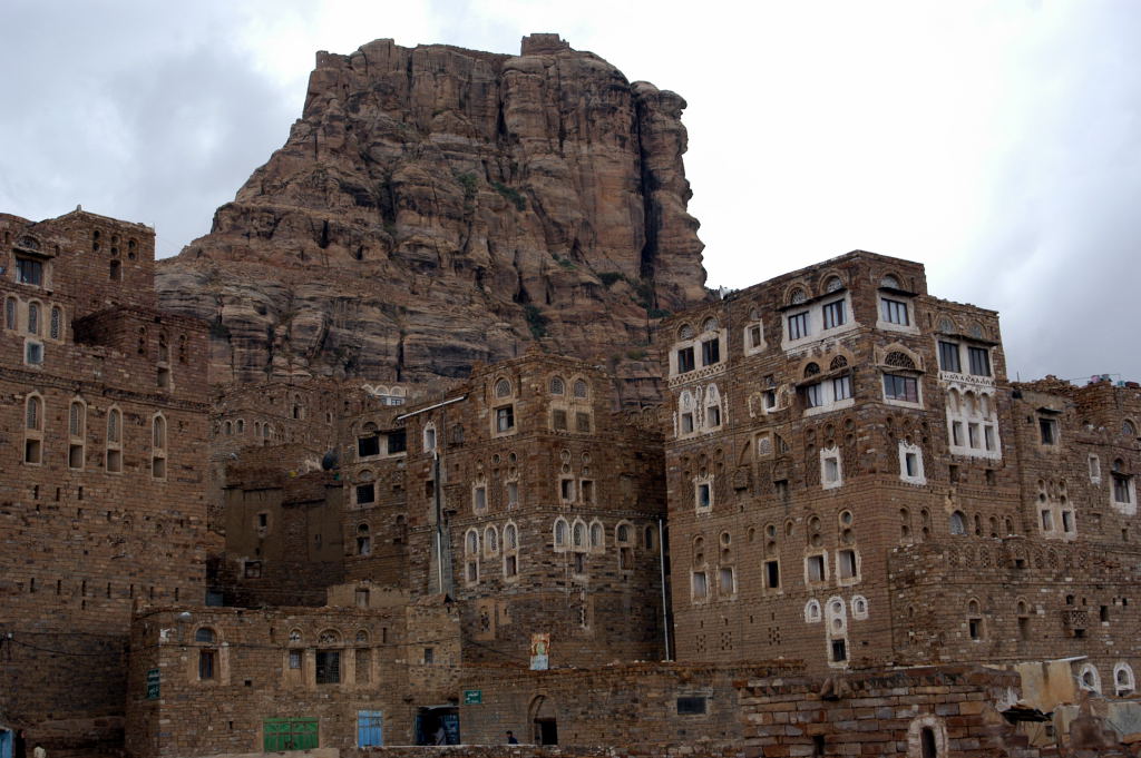
Most of Kawkaban has seen better days. |
|
|

|
|
Part of Kawkaban souq. |
|

|
|
Some perspective of the steepness and elevation of the village location. |
|
|
|

|
|
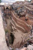
Kawkaban cistern, still in use today. |
|
|
|
|
Another cistern in the village. |
|

|
|
The stairway to the bottom for the cistern. |
|

|
|
This one is in excellent shape. |
|

|
|
This is the main supply of water to the hill top village. |
|
|
|

|
|
On our way down we are accompanied by... |
|

|
|
...a local kid and his herd of goats. |
|

|
|
The town of Shibam not be be confused with the town in Hadramawt. |
|

|
|
Shibam boasts one of the oldest mosques in Yemen. |
|

|
|
An idea of dress code in Yemen. |
|

|
|
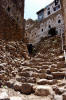
The streets of Thilla (Thula). |
|
|
|

|
|
The village of Thula is better preserved then Kawkaban... |
|

|
|
...and shows some of the better stone houses with decorative windows and doors. |
|

|
|
Thilla (Thula) and the Husn Thula fortress in the background. |
|

|
|
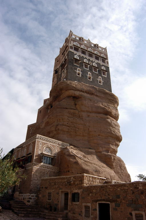
March 24, 2006. Dar al-Hajar located in Wadi Dhahr. |
|

|
|
About 14km northwest of San'a. |
|

|
|
Rock palace called Dar al-Hajar. |
|
|
|

|
|
Five story summer palace built by an imam... |
|

|
|
...around 1786. |
|

|
|
The complete palace is open to public... |
|

|
|
...and gives some great views from every room. Even this tomb room. |
|
|

|
|
The rooms are traditionally furnished. |
|
|
|

|
|
Surrounding landscape and Wadi Dhahr. |
|
|

|
|
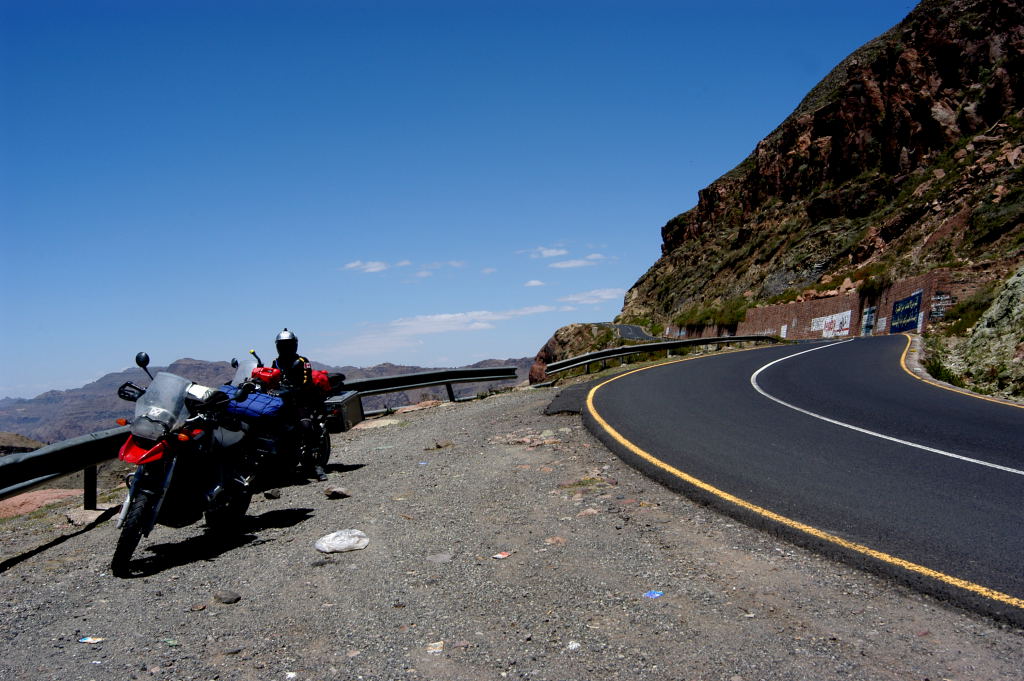
Our journey up to Shaharah (Shihara). |
|

|
|
A journey that none of us will ever forget. |
|

|
|
The 11km climb to the top of the village... |
|

|
|
...took us 3hrs in 4WD Low. |
|
|
|
|

|
|
The steep mountains are terraced for farming. |
|

|
|
The road to hell or to the most incredible place we ever seen. |
|

|
|
The tour book indicates shocking road. It was an understatement. |
|

|
|
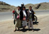
The gang. Olivier, Adnan, Addy, Mike & Ruby. Enjoying every minute of it. |
|

|
|
The town of Shaharah at 2620m. The town cistern. |
|
|
|

|
|
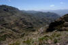
The ususal amazing views. High in the clowds. |
|
|
|
Every space of every mountain is covered with man made terraces for farming. |
|

|
|
Shaharah (Shihara). |
|

|
|
View of the surrounding mountains and wadi below. |
|
|

|
|
We can't believe that people actually life up here. |
|
|
|

|
|
In fact 3000 people call Shaharah (Shihara) home. |
|

|
|
Who built all these terraces. The amount of work is unimagable. |
|

|
|
The people are very friendly. |
|

|
|
A typcial stone house. |
|

|
|
The town even had a jail and court house. |
|

|
|
Our every movement was watched with great interest. |
|
|
|

|
|
The walk to the famouse stone bridge past the town cistern. |
|

|
|
Our first view of the 17th centurey stone bridge. |
|

|
|
This picture is seen on all posters and travel books. |
|

|
|
It is said that the bridge was built by one (1) person. |
|

|
|
Ruby on the bridge. |
|

|
|
The gang hanging out on the bridge. |
|
|
|

|
|
Even for our Yemeni friends this was an experience they won't forget in a long time. |
|

|
|
Mike shooting the machine gun into the gorge. |
|

|
|
The locals showed us around. |
|

|
|
Mike on the bridge. |
|

|
|
The bridge linkstwo villages previously unconnected because of the deep gorge. |
|

|
|
Thank you Adnan & Addy for making this happen. |
|
|
|

|
|
A picture that hold so many great memories. |
|

|
|
The happy couple. |
|
|

|
|
The rulers former home. |
|

|
|
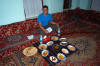
The locals provided a traditional meal for a hungry crew. |
|

|
|
A rainbow frames the town of Shaharah (Shihara) as we leave. What a way to say good-bye. |
|
|
|

|
|
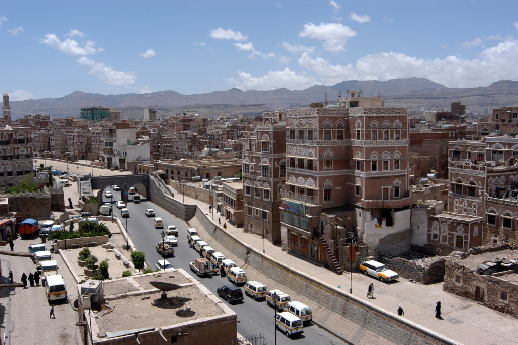
Back in San'a and the view from our hotel. |
|

|
|
San's under blue sky. Due to the surrounding mountains ... |
|

|
|
and high elevation it is rare to see no clouds in the skies. |
|

|
|
Making fresh bread. |
|

|
|
Eating at the old town souq with the locals. Yummy. |
|

|
|
Lula Kabob. Our supper most days. 300 Riyals ($2.00CDN) for 12. |
|
|
|

|
|
Kids playing in the streets of San'a. |
|

|
|
Woman dress code. |
|

|
|
A local resting and chewing qat. |
|

|
|
It is custom for males to hold hands. |
|

|
|
We spend ours watching locals and their customs. |
|

|
|
March 26, 2006. On our way to Manakhah. |
|
|
|
|
|
Local kids selling qat on the side of the road. |
|

|
|
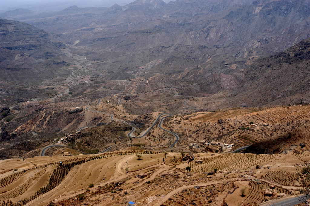
Manakhah is 95km southwest of San'a. The road is incredible as it winds it way through the mountains. |
|

|
|
Hill top villages blend in with surroundings. |
|

|
|
The scenery is gorgeous. |
|
|

|
|
These are the Haraz Mountain Range. |
|
|
|

|
|
Our first view of Al-Hajjarah. |
|

|
|
A 11th century hilltop village. |
|

|
|
The village is very well preserved. |
|

|
|
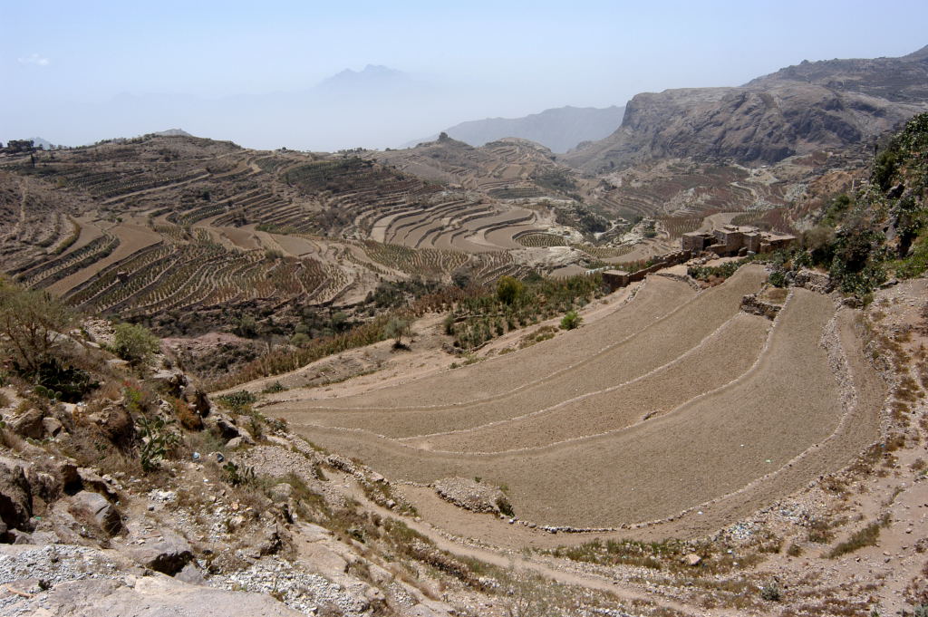
A view of its terraces for growing qat and coffee. |
|

|
|
The steps leading to the only entrance gate to the walled town of Al-Hajjarah. |
|

|
|
This gate still closes every night at 8pm. |
|
|
|

|
|
A local boy was our guide for the day. |
|
|

|
|
The date is ingraved in the header of the door. |
|

|
|
This shows how the houses are built on the edge of cliffs. |
|
|
|
Local streets. |
|

|
|
Al-Hajjarah originally was divided into two. The upper portion was the Muslim quarter. |
|
|
|

|
|
And the lower part outside the gate was the Al-Ba'aha quarter inhabited by Jews, which fled to Israel in the 1950's. |
|

|
|
The village is a great place to explore. |
|

|
|
And so many picture opportunities. |
|

|
|
We decide to stay the night at the local Funduq (guesthouse). |
|

|
|
Funduq normally provides you with a room and a mattress on the floor. Separate bathroom. Very cozy. |
|

|
|
We decide to take a 7km hike into the wadi below... |
|
|
|

|
|
... guided by the local boy we pass by dry cisterns.... |
|

|
|
...coffee and qat plantations. |
|
|

|
|
...it definitely proved better to walk then take the motorcycles. |
|

|
|
Coffee trees. Or maybe qat trees. |
|

|
|
Our hike takes us through another hill top village. |
|
|
|

|
|
Steps into a cistern. |
|

|
|
A local builts this first level of his home by hand. The construction has taken him 6 years. Each stone is carved by hand. |
|

|
|
Different vegetation. |
|

|
|
Another view of Al-Hajjarah. |
|

|
|
The locals built these villages on these hill tops to protect from intruders and to allow for the use of more farm land. |
|
|
|
Supper at the funduq. A meal for a King. The food is great in Yemen. |
|
|
|

|
|
Locals dancings. |
|

|
|
Of course I was pulled into the middle of the festivities. |
|

|
|
It was great to watch. |
|

|
|
Something that we are glad we experienced. |
|

|
|
Hanging out with the musicians and dancers. |
|

|
|
Scenery from San'a south to Ta'izz. |
|
|
|

|
|
The mountain ranges become more green. |
|

|
|
The terraces are being farmed already. |
|

|
|
Excellent paved roads for a change. |
|

|
|
Mountain range just before descending into Ibb. |
|
|
|
2800m high pass. |
|
|
|
|
|

|
|
Bab al-Kabir, the main entrance to the old town in Ta'izz. Souq in full swing. |
|

|
|
One of the two (2) gates remaining. |
|

|
|
Climbing Jebel Sabir and a view of Qalat al -Qahira fortress. |
|
|

|
|
The taxi drops us off at the top of Jebel Sabir (3010m) and disappears. |
|
|
|

|
|
The view from the top of Jebel Sabir. |
|
|

|
|
As we walk through the hill top village we are asked to ... |
|

|
|
...pictures of the locals. They love seeing their picture on the digital camera. |
|

|
|
March 30, 2006. Zabid, originally built in AD 820 and now a World Heritage Site. Main Gate Entrance. |
|

|
|
Staying in Al-Hudayda. The motorcycles and Mike attract the ususal attention. |
|
|
|

|
|
Setting up camp on the Red Sea. |
|

|
|
Our home for a night by Salif Port. |
|

|
|
Ocean, sun and a couple chairs. What else do you need. |
|

|
|
Shell collecting on the beach. |
|

|
|
Watching the sun set... |
|

|
|
...in Yemen. Good-bye to a most memorable country. |
|
|